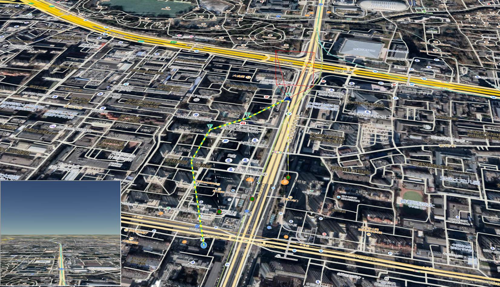
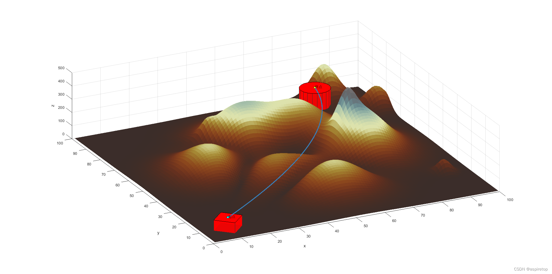
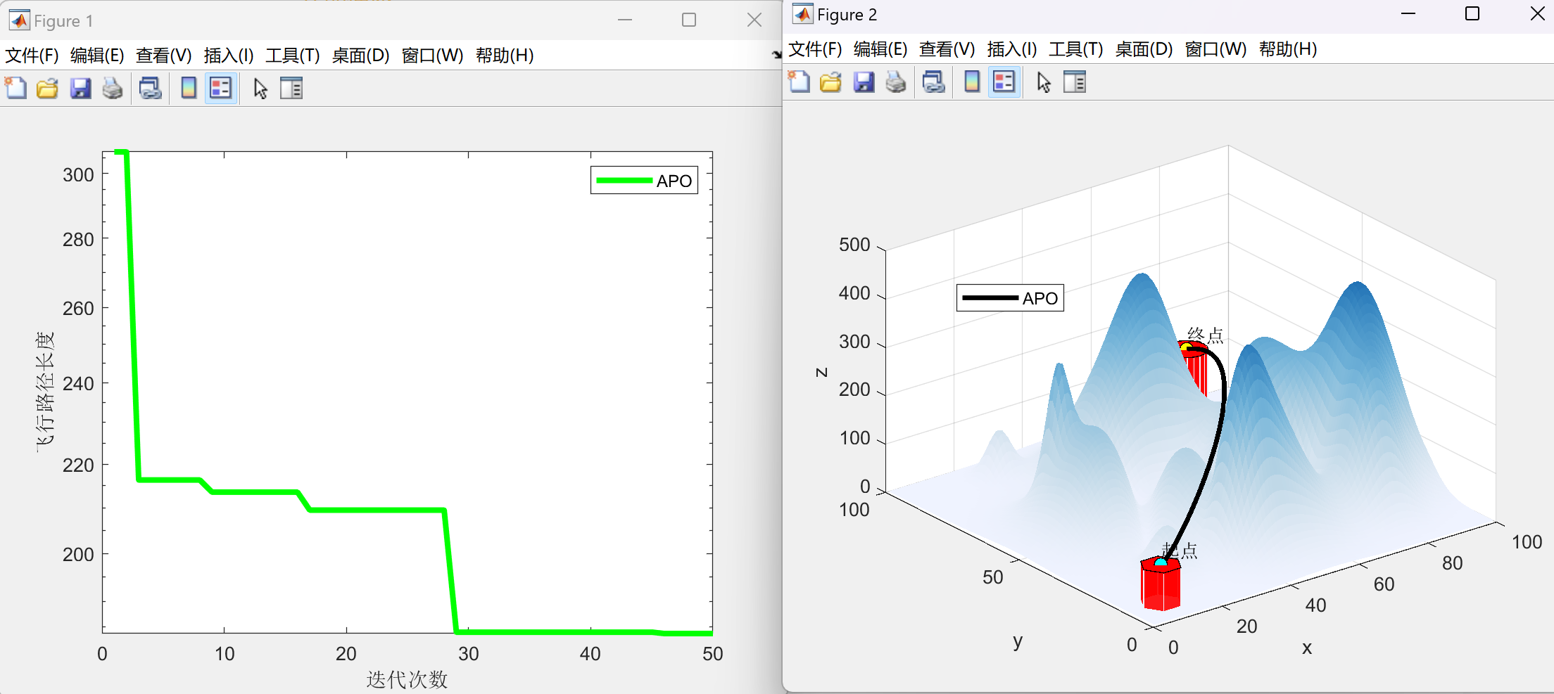
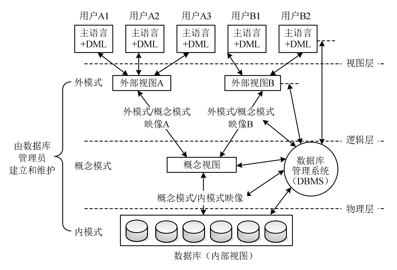
无人机航点、航线规划,实现全自动航点飞行作业及飞行航拍。禁飞区、作业区功能保障飞行安全。
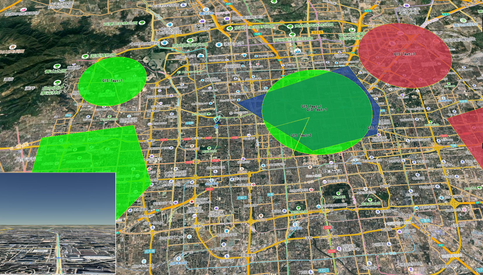
GIS引擎加载
const viewer = new Cesium.Viewer("cesiumContainer", {
imageryProvider: new Cesium.IonImageryProvider({ assetId: 3872 }),
});
const imageryLayers = viewer.imageryLayers;
const nightLayer = imageryLayers.get(0);
const dayLayer = imageryLayers.addImageryProvider(
new Cesium.IonImageryProvider({
assetId: 3875,
})
);
imageryLayers.lowerToBottom(dayLayer);
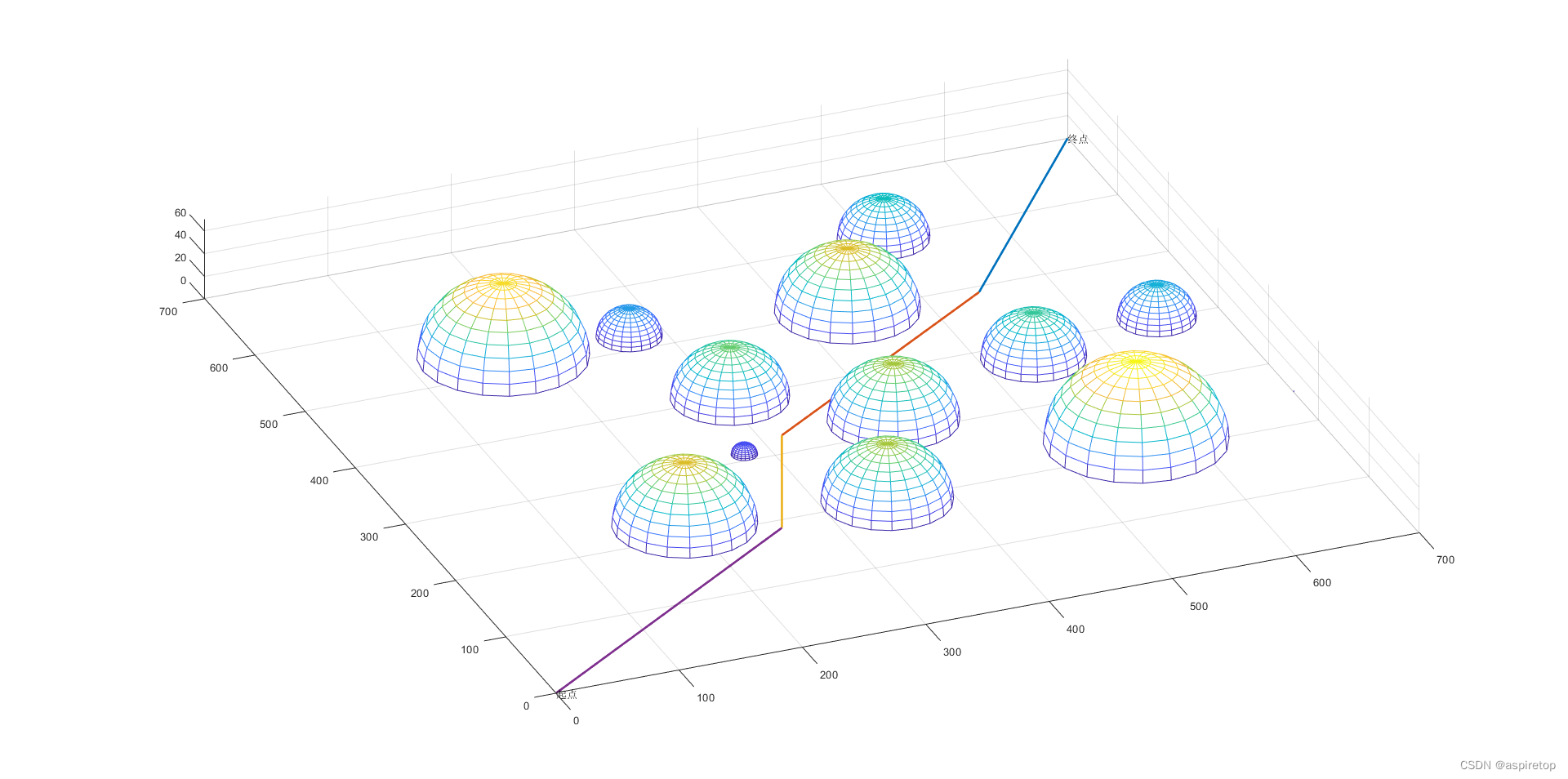
GIS航线


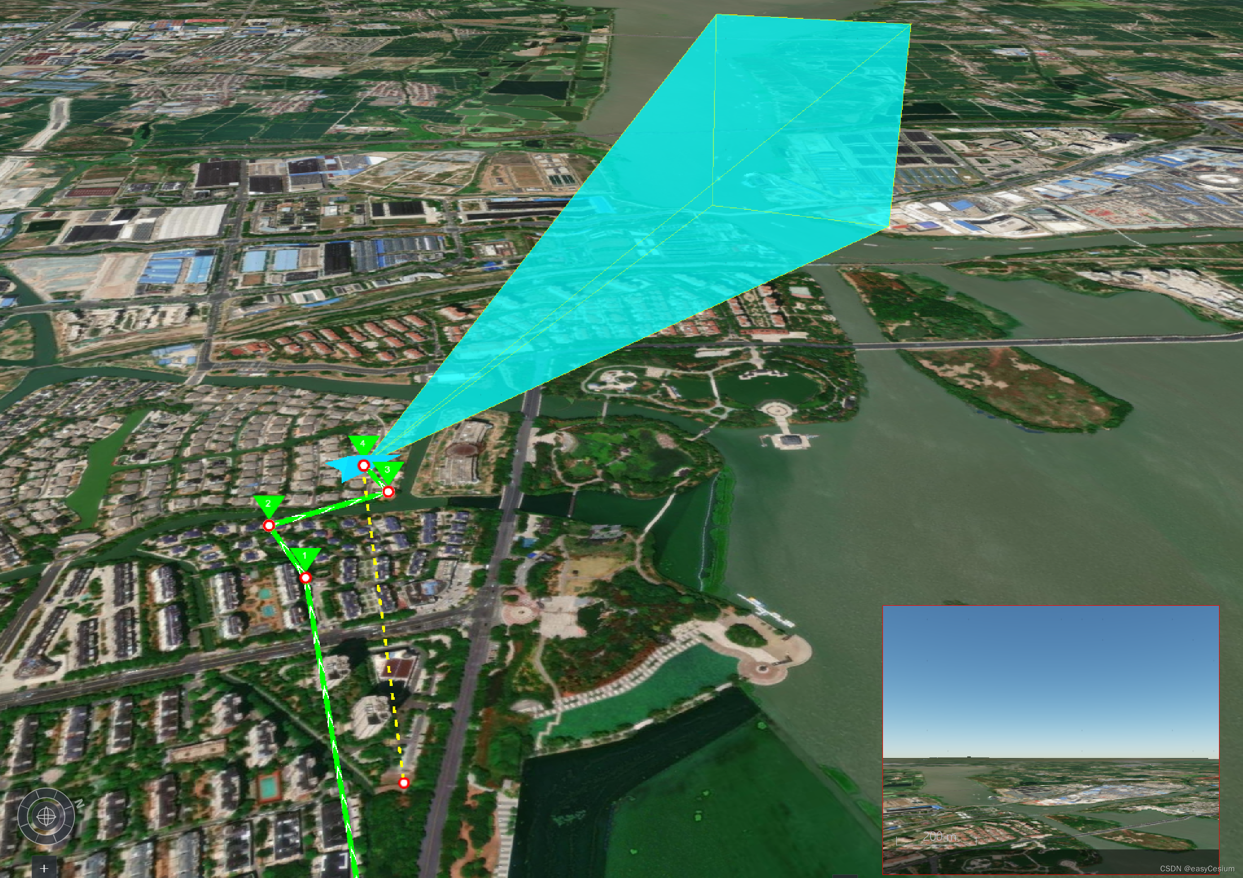
多相机联动
GIS多相机联动
航线加载
const czml = [
  {
    id: "document",
    name: "CZML Geometries: Polyline",
    version: "1.0",
  },
  {
    id: "redLine",
    name: "Red line clamped to terain",
    polyline: {
      positions: {
        cartographicDegrees: [-75, 35, 0, -125, 35, 0],
      },
      material: {
        solidColor: {
          color: {
            rgba: [255, 0, 0, 255],
          },
        },
      },
      width: 5,
      clampToGround: true,
    },
  },
  {
    id: "blueLine",
    name: "Glowing blue line on the surface",
    polyline: {
      positions: {
        cartographicDegrees: [-75, 37, 0, -125, 37, 0],
      },
      material: {
        polylineGlow: {
          color: {
            rgba: [100, 149, 237, 255],
          },
          glowPower: 0.2,
          taperPower: 0.5,
        },
      },
      width: 10,
    },
  },
  {
    id: "orangeLine",
    name:
      "Orange line with black outline at height and following the surface",
    polyline: {
      positions: {
        cartographicDegrees: [-75, 39, 250000, -125, 39, 250000],
      },
      material: {
        polylineOutline: {
          color: {
            rgba: [255, 165, 0, 255],
          },
          outlineColor: {
            rgba: [0, 0, 0, 255],
          },
          outlineWidth: 2,
        },
      },
      width: 5,
    },
  },
  {
    id: "purpleLine",
    name: "Purple arrow at height",
    polyline: {
      positions: {
        cartographicDegrees: [-75, 43, 500000, -125, 43, 500000],
      },
      material: {
        polylineArrow: {
          color: {
            rgba: [148, 0, 211, 255],
          },
        },
      },
      arcType: "NONE",
      width: 10,
    },
  },
  {
    id: "dashedLine",
    name: "Blue dashed line",
    polyline: {
      positions: {
        cartographicDegrees: [-75, 45, 500000, -125, 45, 500000],
      },
      material: {
        polylineDash: {
          color: {
            rgba: [0, 255, 255, 255],
          },
        },
      },
      width: 4,
    },
  },
];

const dataSourcePromise = Cesium.CzmlDataSource.load(czml);
viewer.dataSources.add(dataSourcePromise);
感兴趣的可以留言或发邮件1985692469@qq.com,欢迎一起交流!


![每日一题 --- 两两交换链表中的节点[力扣][Go]](https://img-blog.csdnimg.cn/img_convert/1dabc9d4069288b44452a0dee37d5b6c.jpeg)